“Great things are done when men and mountains meet.” - Part I
walkwithme·@danielapetk·
0.000 HBD“Great things are done when men and mountains meet.” - Part I
<center> # Rila Monastery </center> <br> </br> <div class="pull-right"> 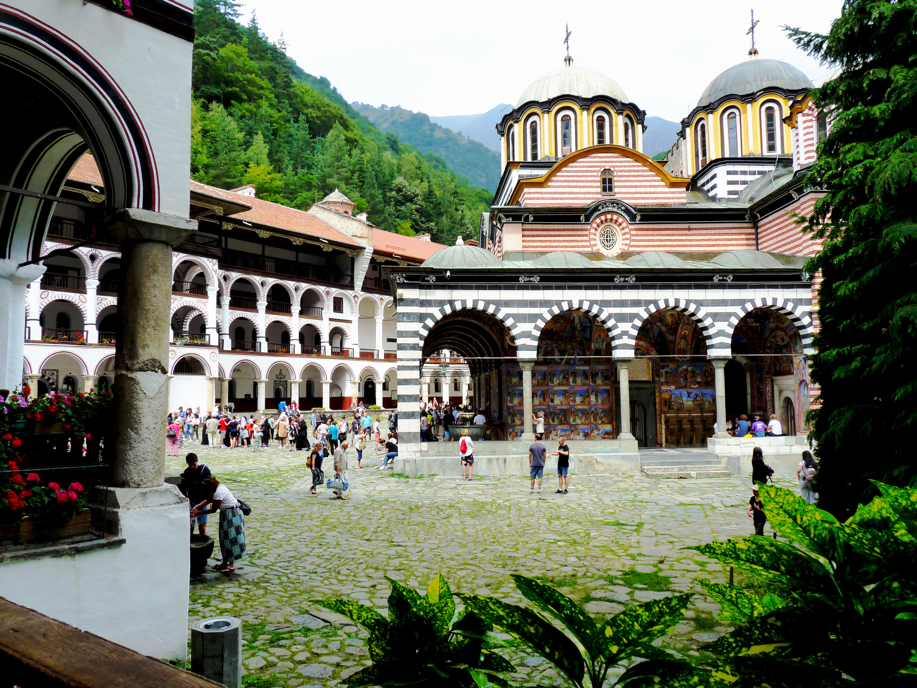 </div> **Rila Monastery** or **The Monastery of Saint Ivan of Rila** is the most famous and the largest Eastern Ortodox monastery in **Bulgaria**. It is located in the low parts of southwest Rila Mountains, in the boundaries of Rila National Park at an elevation of 1,147m (3, 763 ft). It carries the name of his founder - St Ivan Rilski. Actually he was living in a cave close to the site of the monastery and his students founded it in the 10 century. Today there live around 60 monks. > ###### *Saint John of Rila (Bulgarian: Свети Йоан (Иван) Рилски, sveti Ioan Rilski) (876 – c. 946) was the first Bulgarian hermit. He was revered as a saint while he was still alive. The legend surrounding him tells of wild animals that freely came up to him and birds that landed in his hands. His followers founded many churches in his honor, including the famous Rila Monastery. One of these churches, "St Ivan Rilski" was only discovered in 2008 in the town of Veliko Tarnovo. Today, he is honored as the patron saint of the Bulgarians and as one of the most important saints in the Bulgarian Orthodox Church.* [Source - Wikipedia](https://en.wikipedia.org/wiki/John_of_Rila) <br> </br> For me it is on the other side of the mountain because I live closer to its north part and I've hiked mostly around that part because it is more convenient for me. One of the hikes that I really wanted to do this summer was either from my part to Rila Monastery and back or the opposite way. The problem was that it is really long and not suitable for 1 day hike for me even thought I am fast it is almost impossible unless you are a mountain runner. The better choice is to do it with one night in the mountain and only in one direction, at least for the knees. But to carry camping equipment around the mountain is also not easy at all. Actually I get lower back pain if I carry even not so heavy backpack. That's why instead of stopping hiking I stopped carrying backpack, shoes and poles. (and my lower back problems disappeared of course). Two months ago I was chatting with a friend of mine and he told me that he was for the first time near a little chapel on a hill in our part of the mountain with amazing view of some high peaks. That little chapel has really interesting story and it is also called St. Ivan Rilski because when people were transferring his remains from the city Veliko Turnovo back to The Rila Monastery they passed by that hill in Rila and after that a big church was built there, later demolished. I'll write more about its story in the next part. My friend is not that religious but more I would call it spiritual. He wanted to go to The Rila Monastery, take an icon from there and bring it to the other side of the mountain and leave it in the chapel - like if Ivan Rilski is crossing the mountain again.Of course I was happy to go on the long hike with him. So our first step was the monastery a Saturday morning three weeks ago. 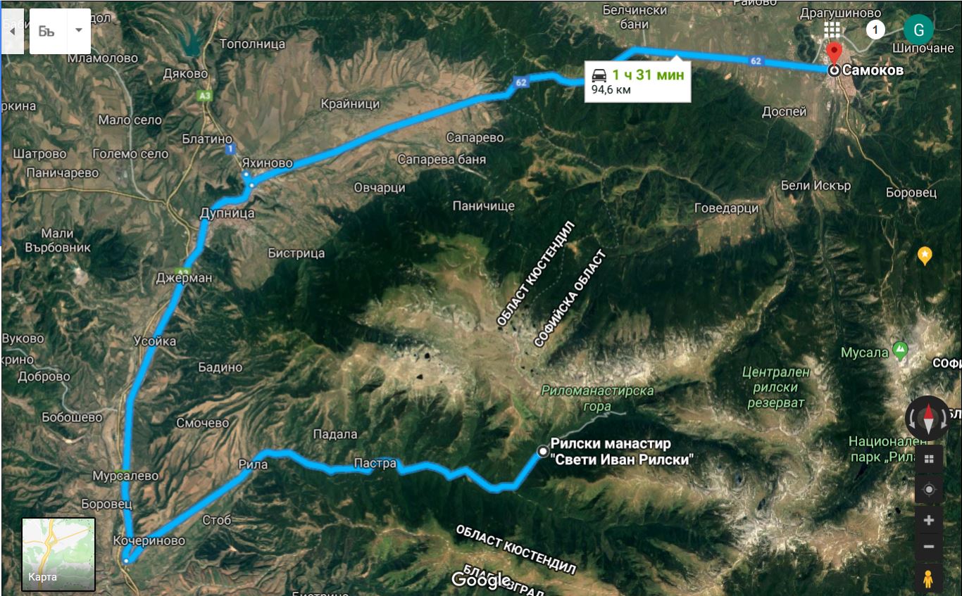 We looked around the monastery, took some photos, ate some [мекици](https://en.wikipedia.org/wiki/Mekitsa) (they were so delicious) and were ready to start our long way back home. And of course we took an icon of St Ivan Rilski from the monastery. 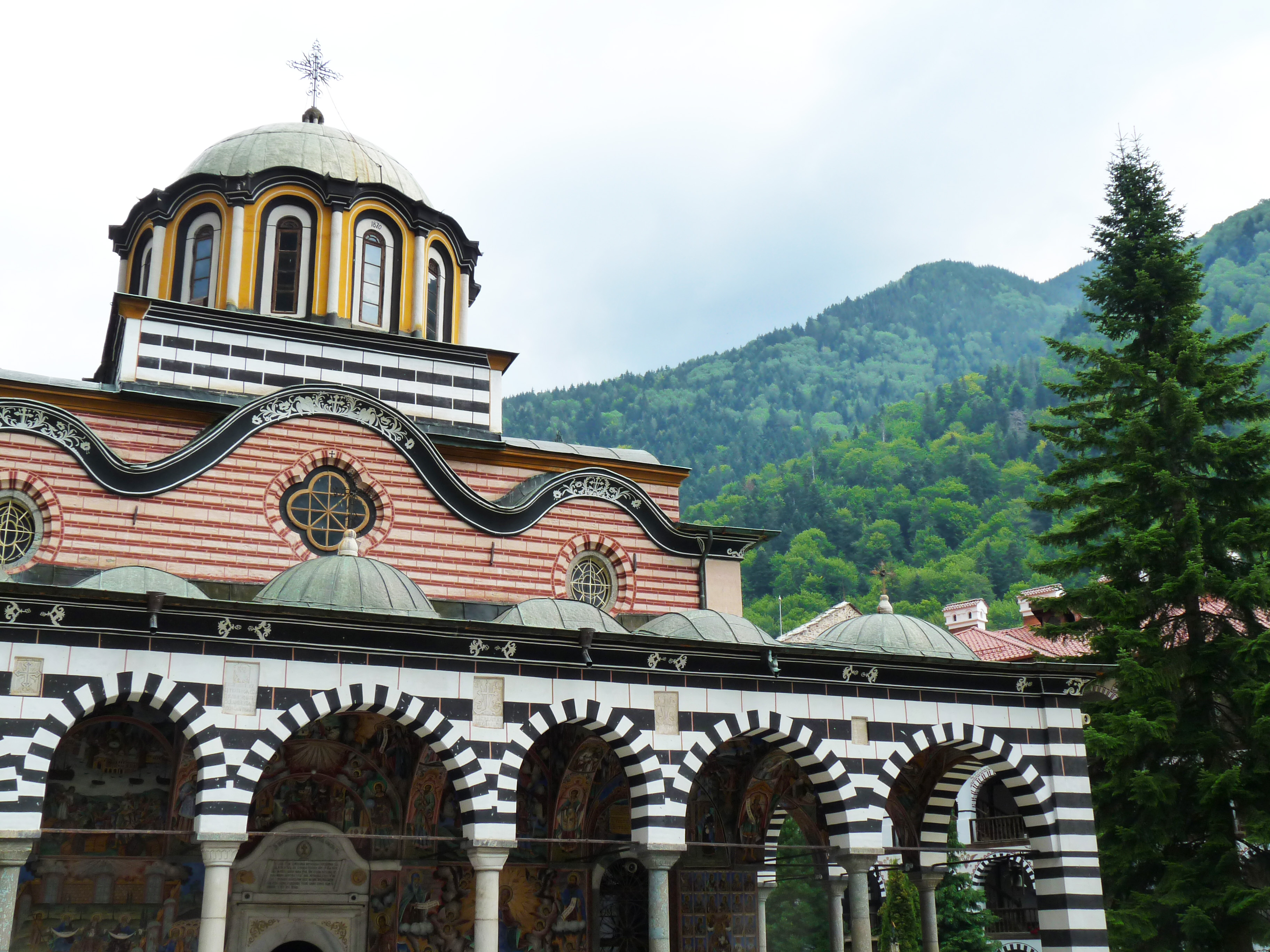 ###### *The main church of the monastery was erected in the middle of the 19th century.* <br> </br> 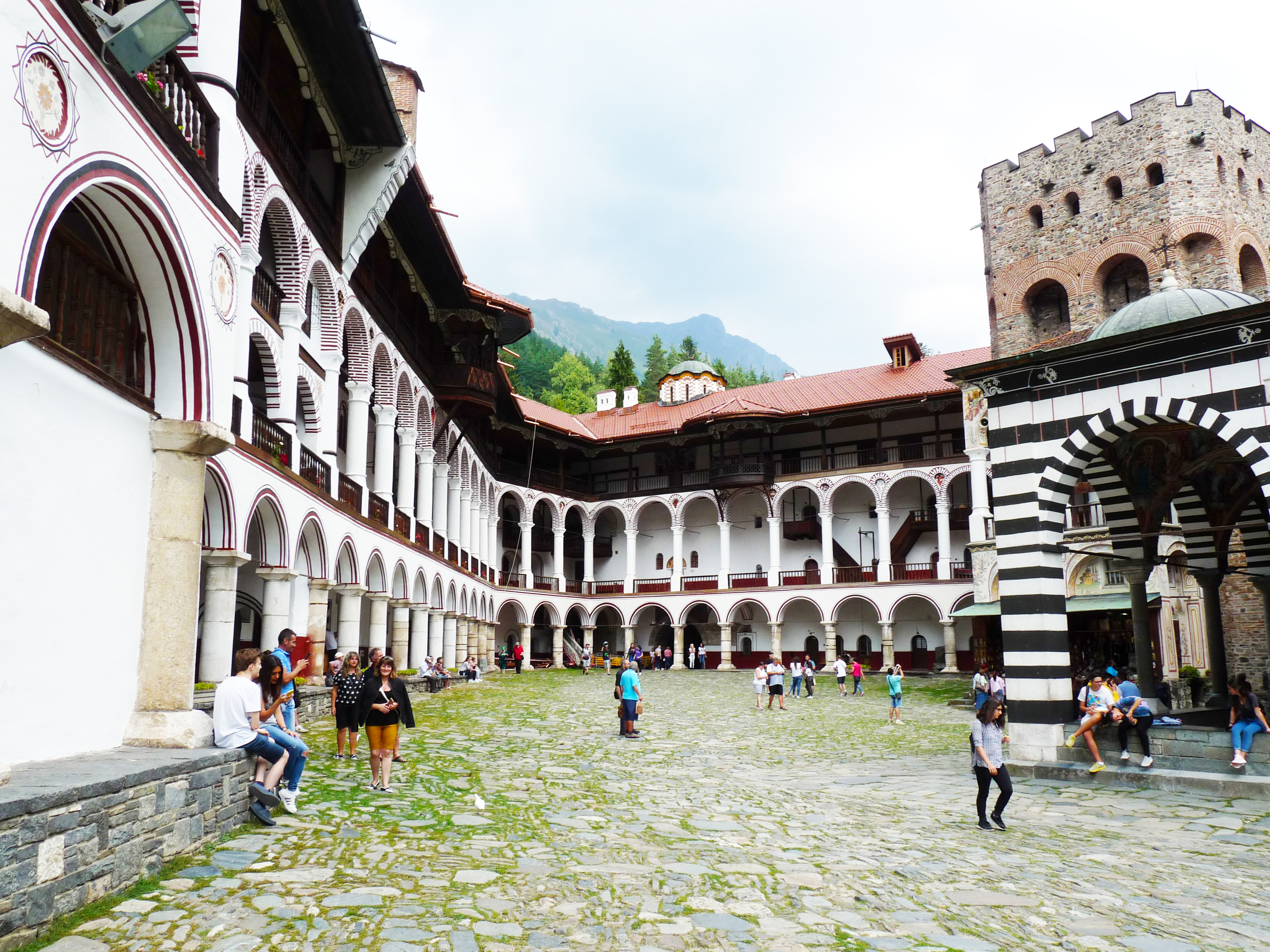 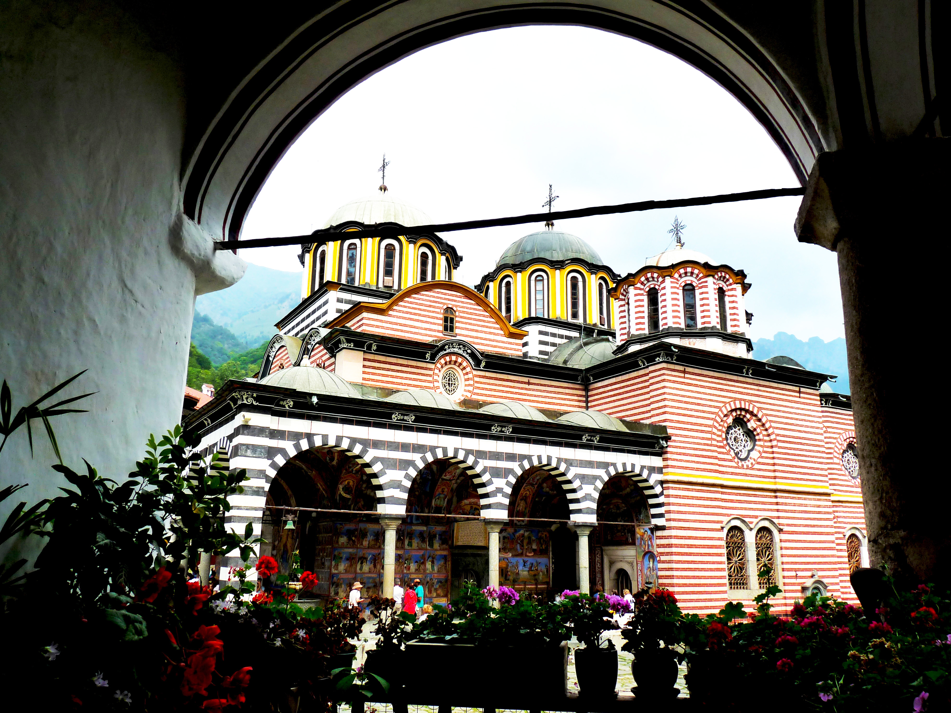 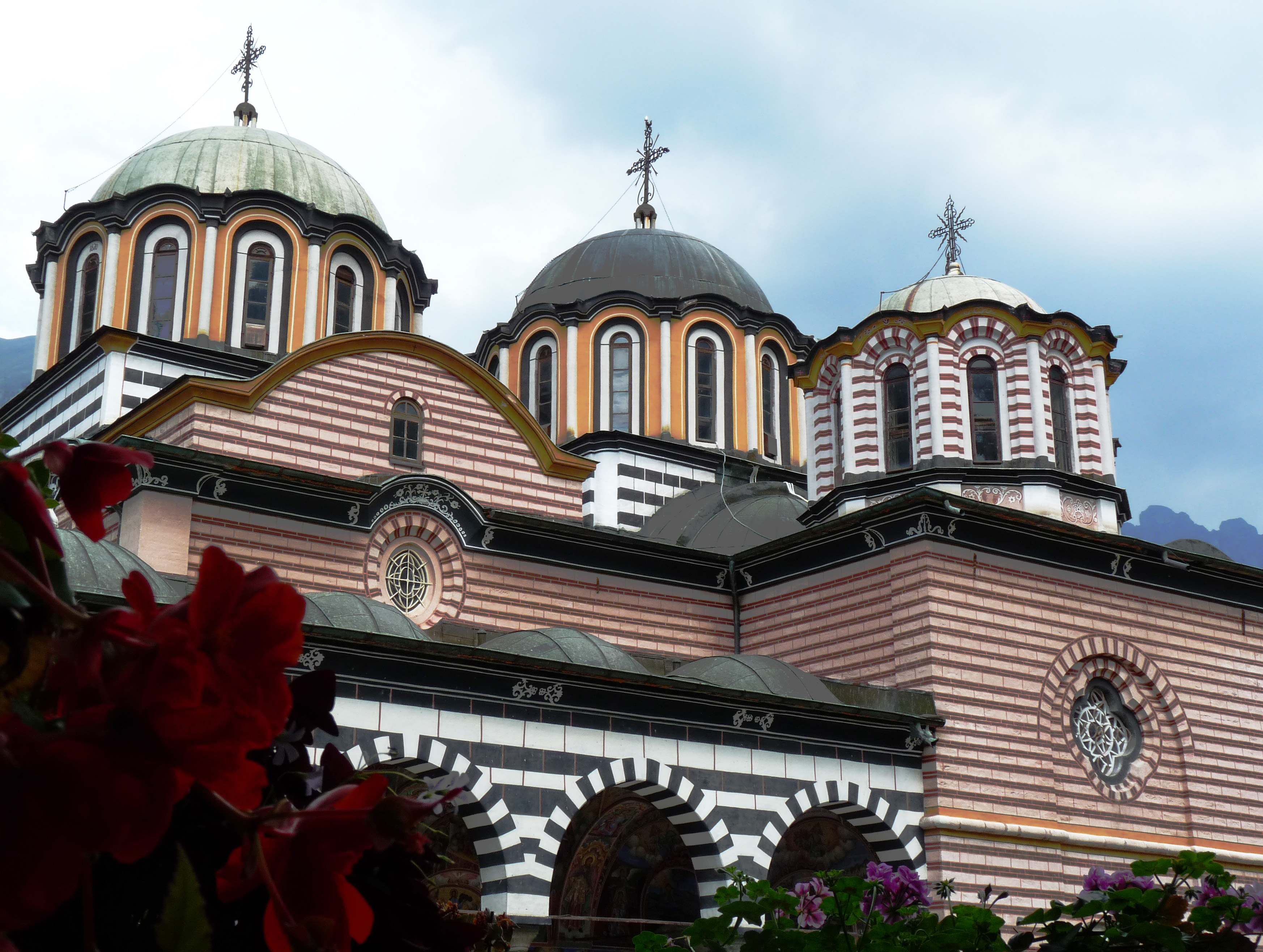 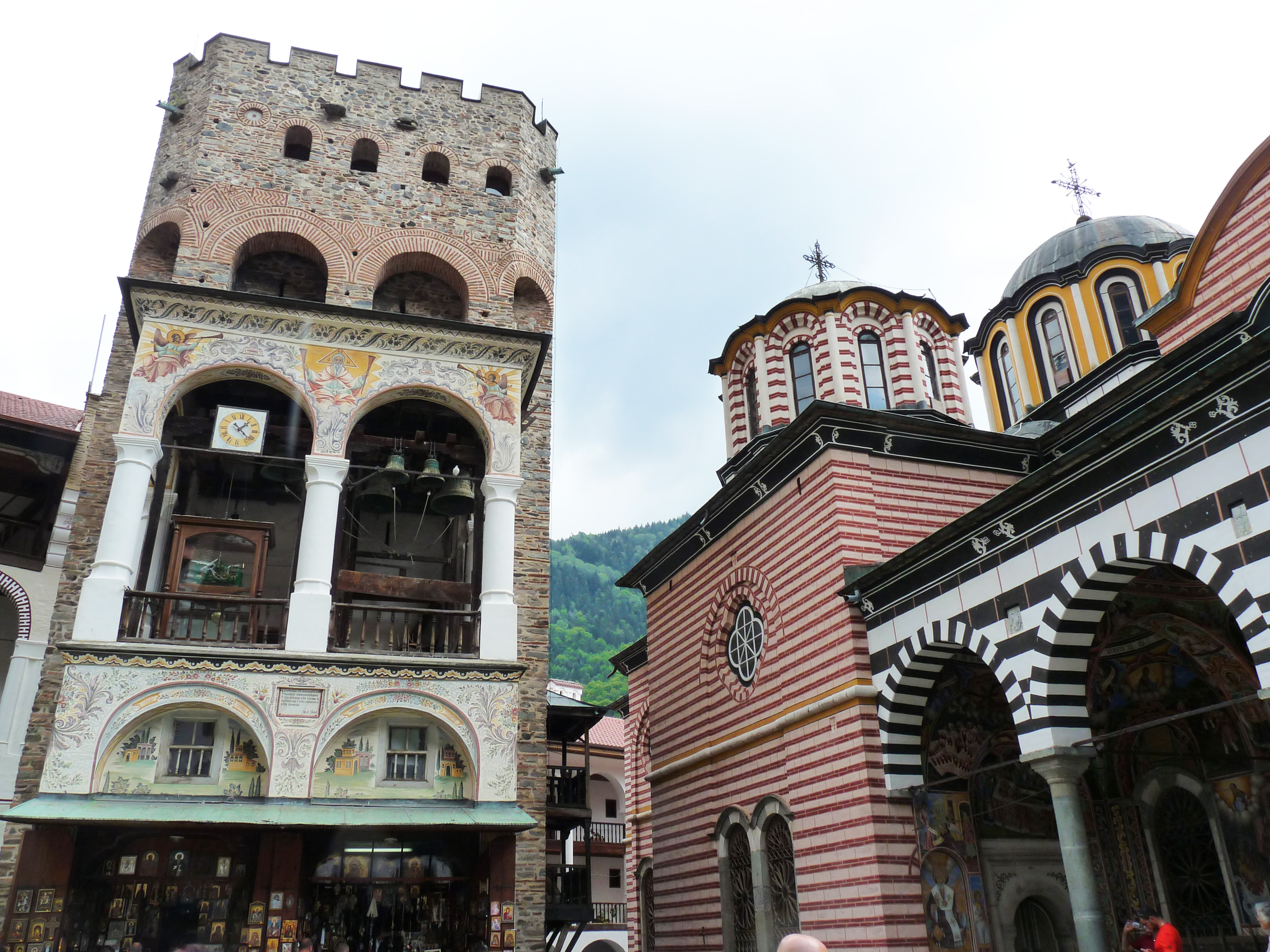 <center> ** </center> ###### *The tower on the left is the oldest building in the complex now - built in 1334* <br> </br> 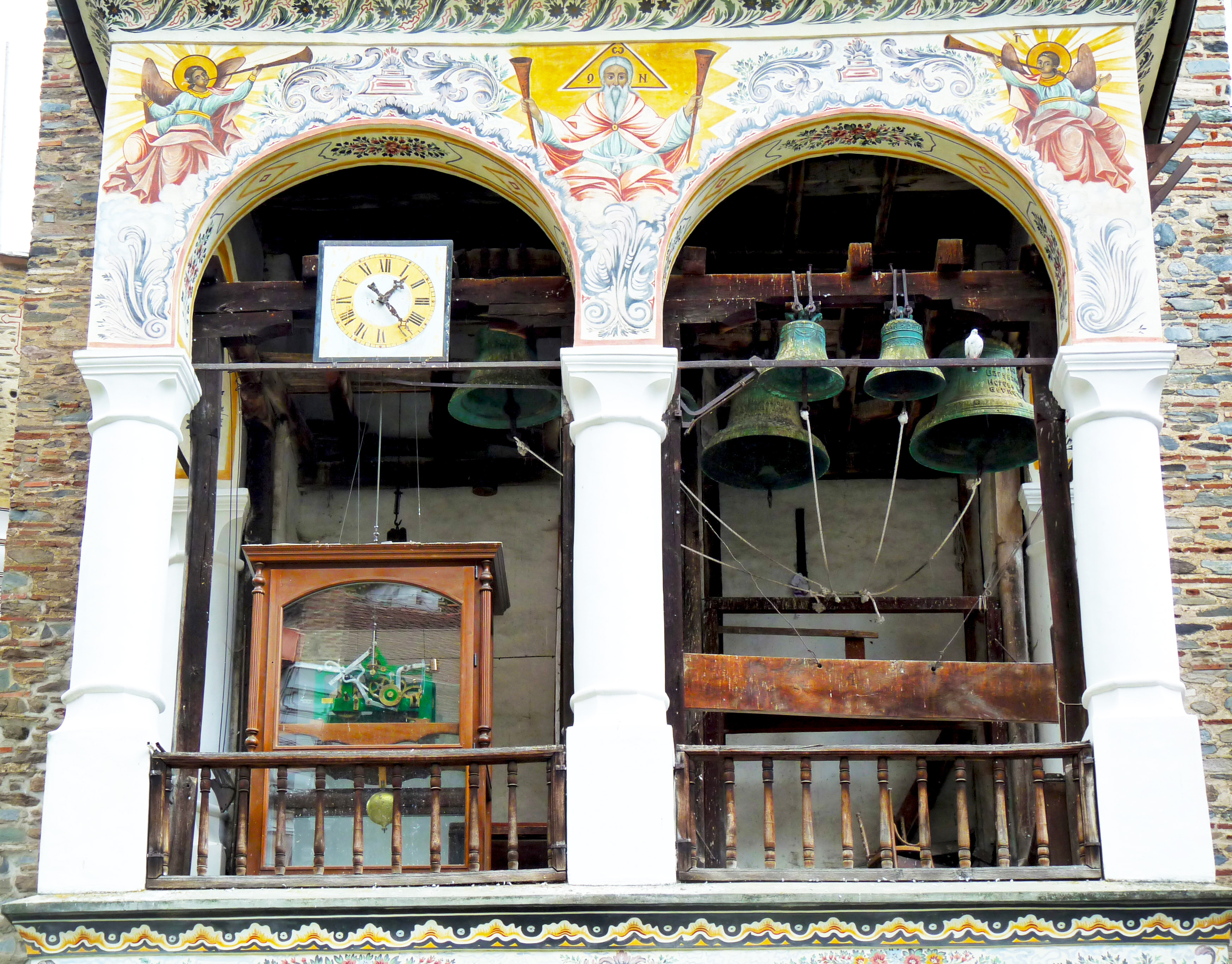 ###### *The tower of Hrelja* <br> </br> > ###### *Hrelja also known as Stefan Dragovolor was a 14th-century semi-independent feudal lord in the region of northeastern Macedonia and the Rila mountains who served medieval Serbian kings Stefan Milutin, Stefan Dečanski and Stefan Dušan. He is known for reconstructing the Rila Monastery, Bulgaria's largest monastery, in 1334–1335.* [Source - Wikipedia](https://en.wikipedia.org/wiki/Hrelja) 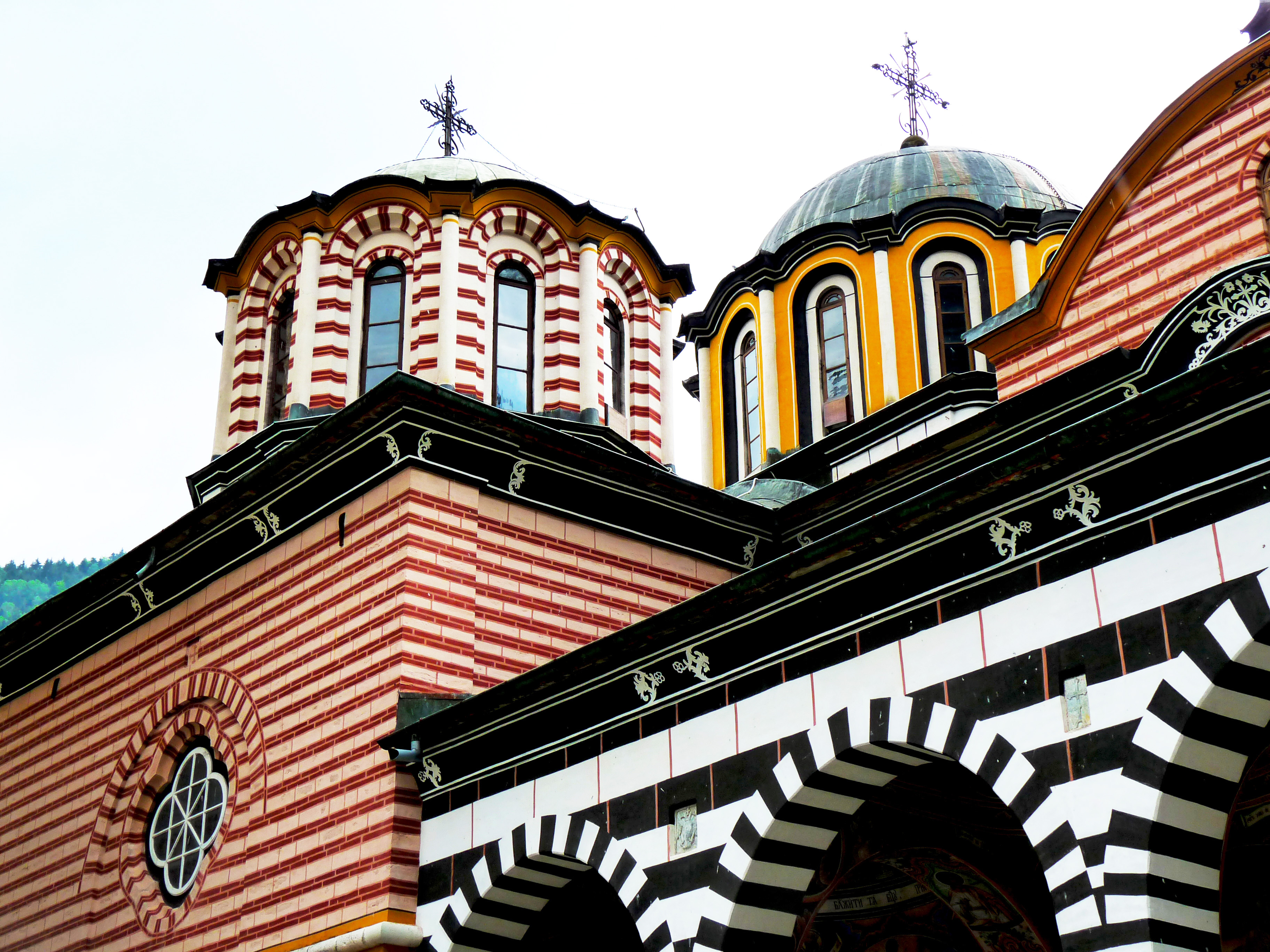 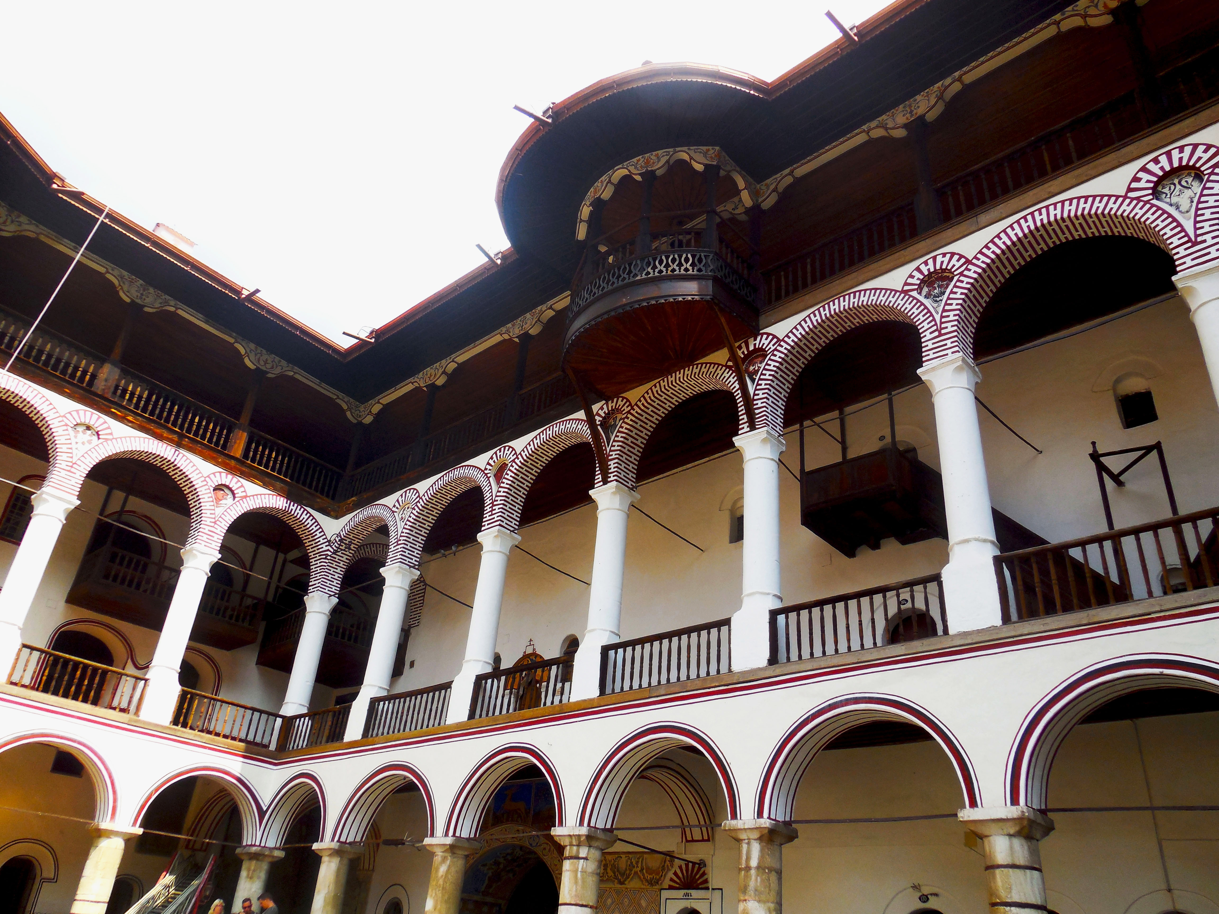 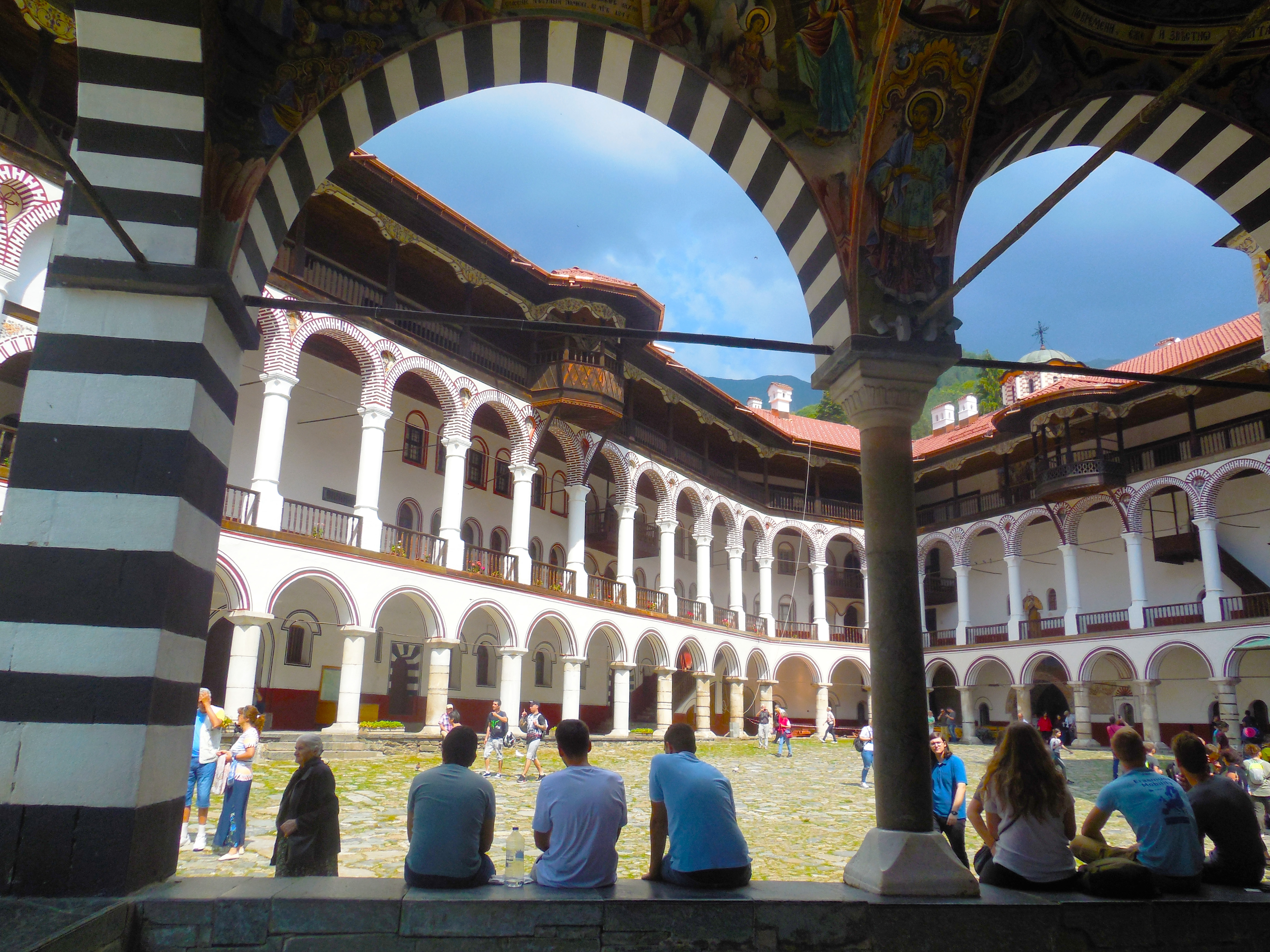 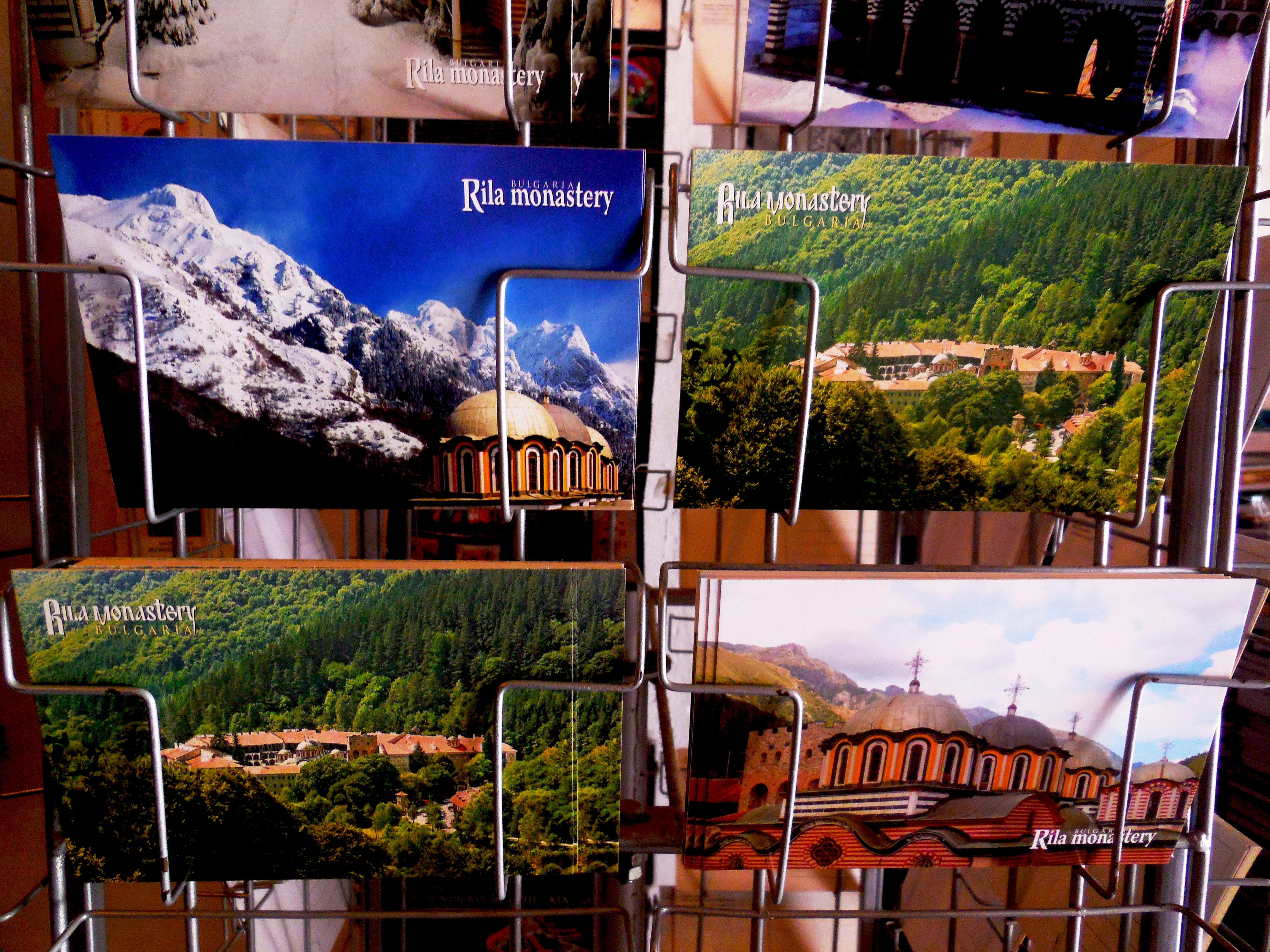.jpg) ###### *Postcards with the monastery* <br> </br> 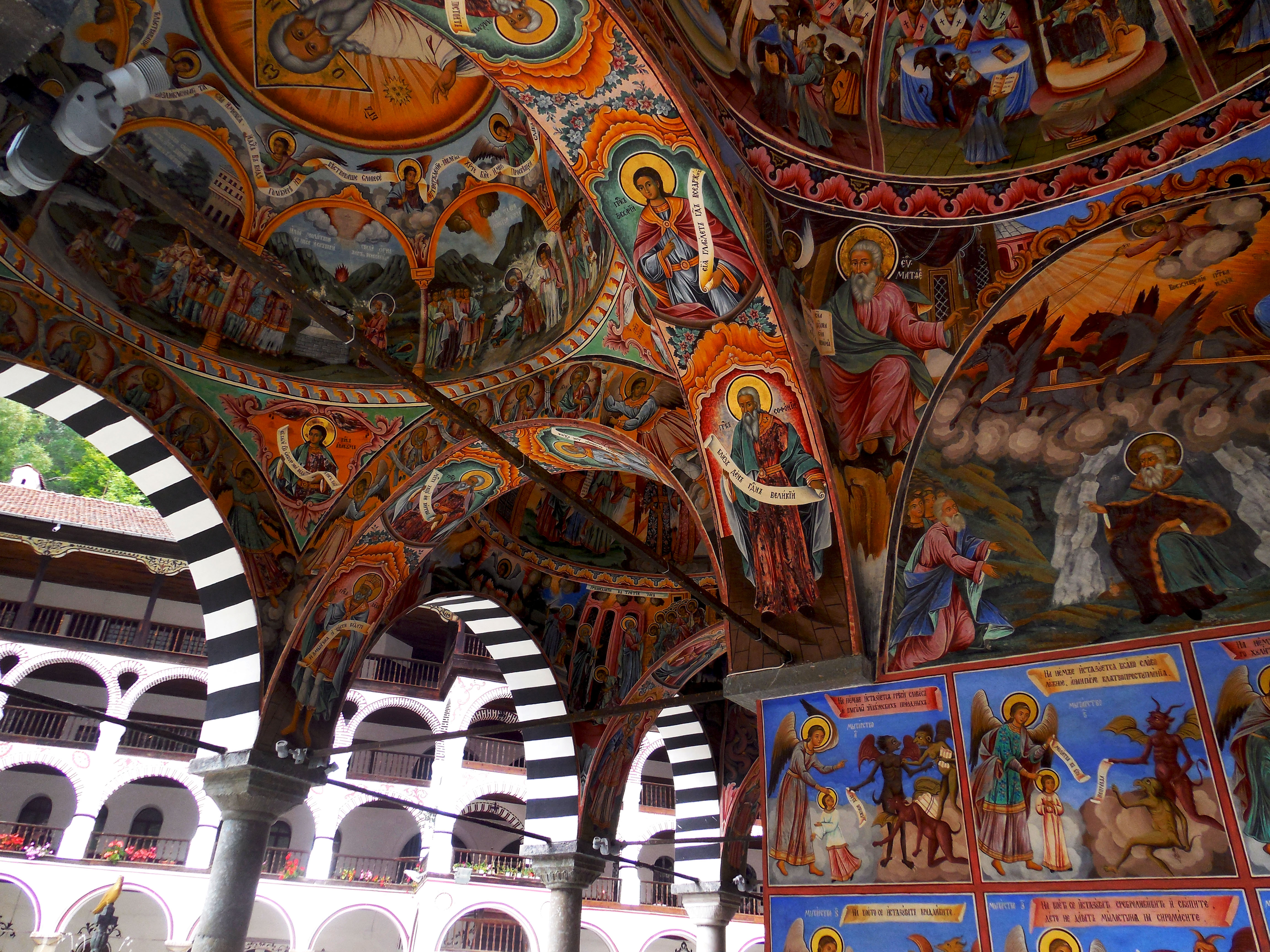 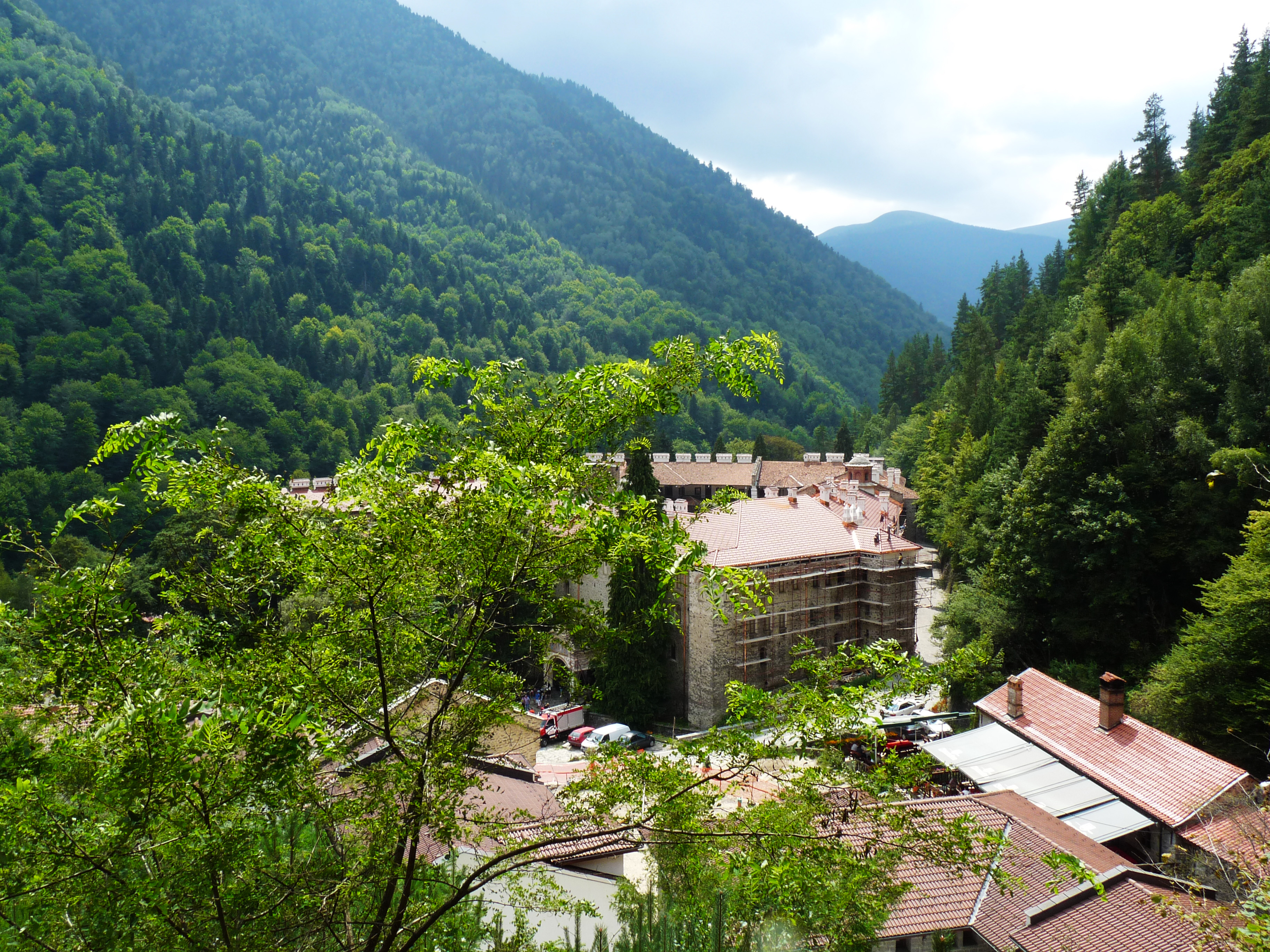 ###### *The monastery from the start of our pathway - The Long Ridge* <br> </br> 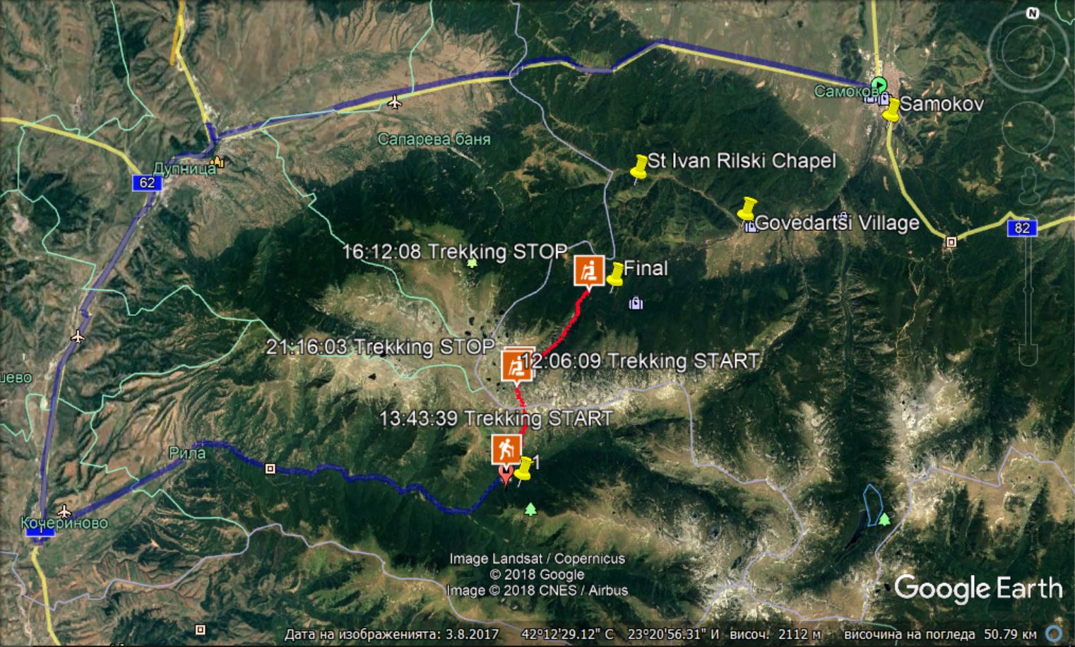 ###### *Here you can see our trip from Samokov to the Monastrery, our trek and the chapel* <br> </br> <center> # The Longe Ridge </center> The first part of our hike was a pathway called The Long Ridge. And why it is called like that? Because it is long and long and long and steep and monotonous and exhausting. Not that this was something new for us . That is what I was thinking. After the first 30 minutes my face was bloody red, my back was wet(I was with a backpack too, because I had to) and I was more ready to come back than to continue but I knew that feeling very well, it was supposed to continue for 1 more hour and then to disappear. Once I am deeper in the mountain, the mountain gives me strength and endurance. Again - at least I thought so :D That was just not my day that time, or the long ridge was really too long. It was endless. <div class="pull-right"> 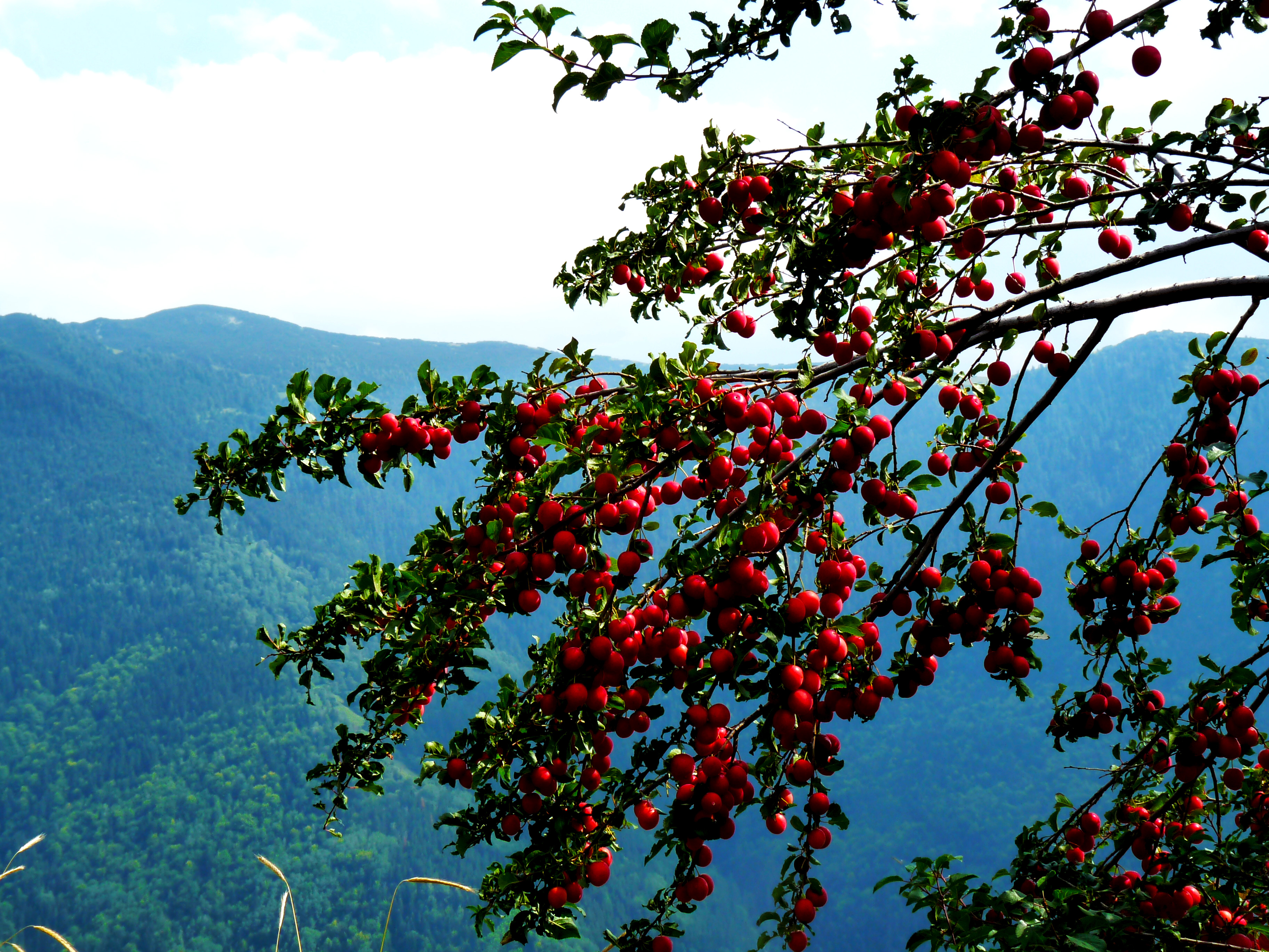 </div> I usually don't eat the food that I carry in my backpack before the end of the hike, because I am not hungry while I am walking. But that time there were at first hazelnuts and plums near the pathway and later big and sweet blueberries, so most of the time I was chewing something really delicious. They were not only feeding me and giving me energy, but also distracting me from the tiredness. Some insects and animals were doing the same: like this guy. 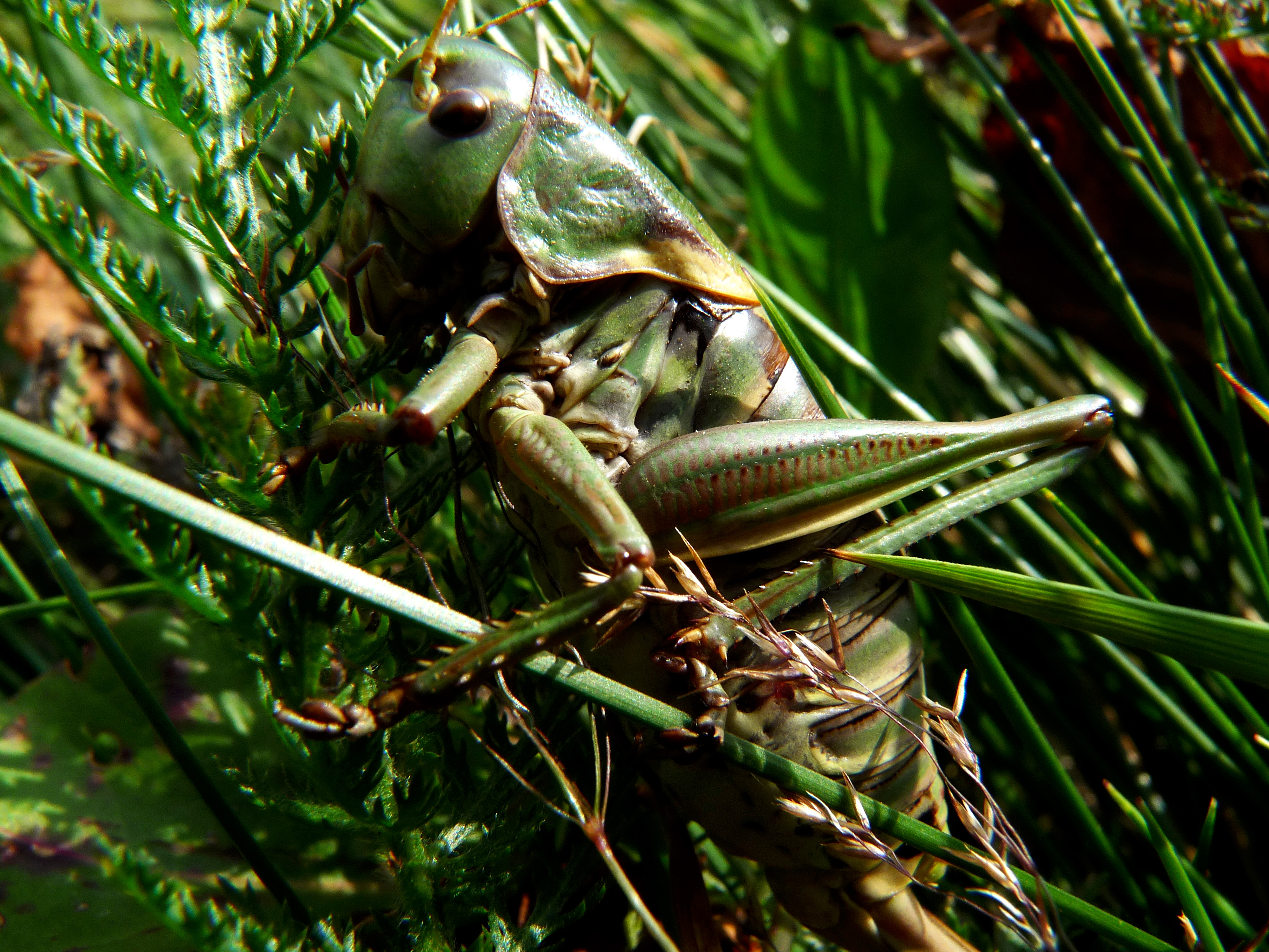 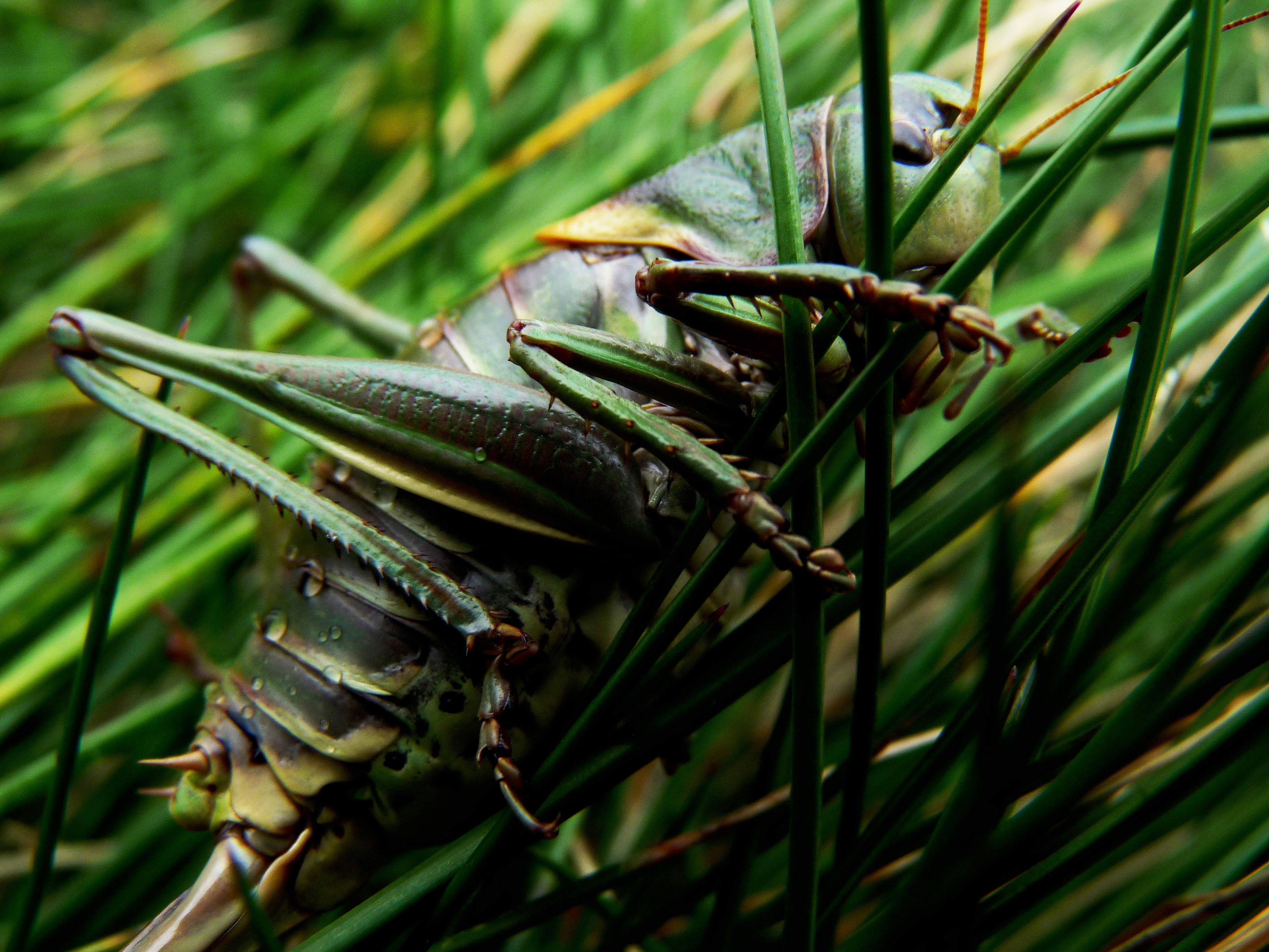.jpg) And of course the beautiful mountains and flowers were helping too. 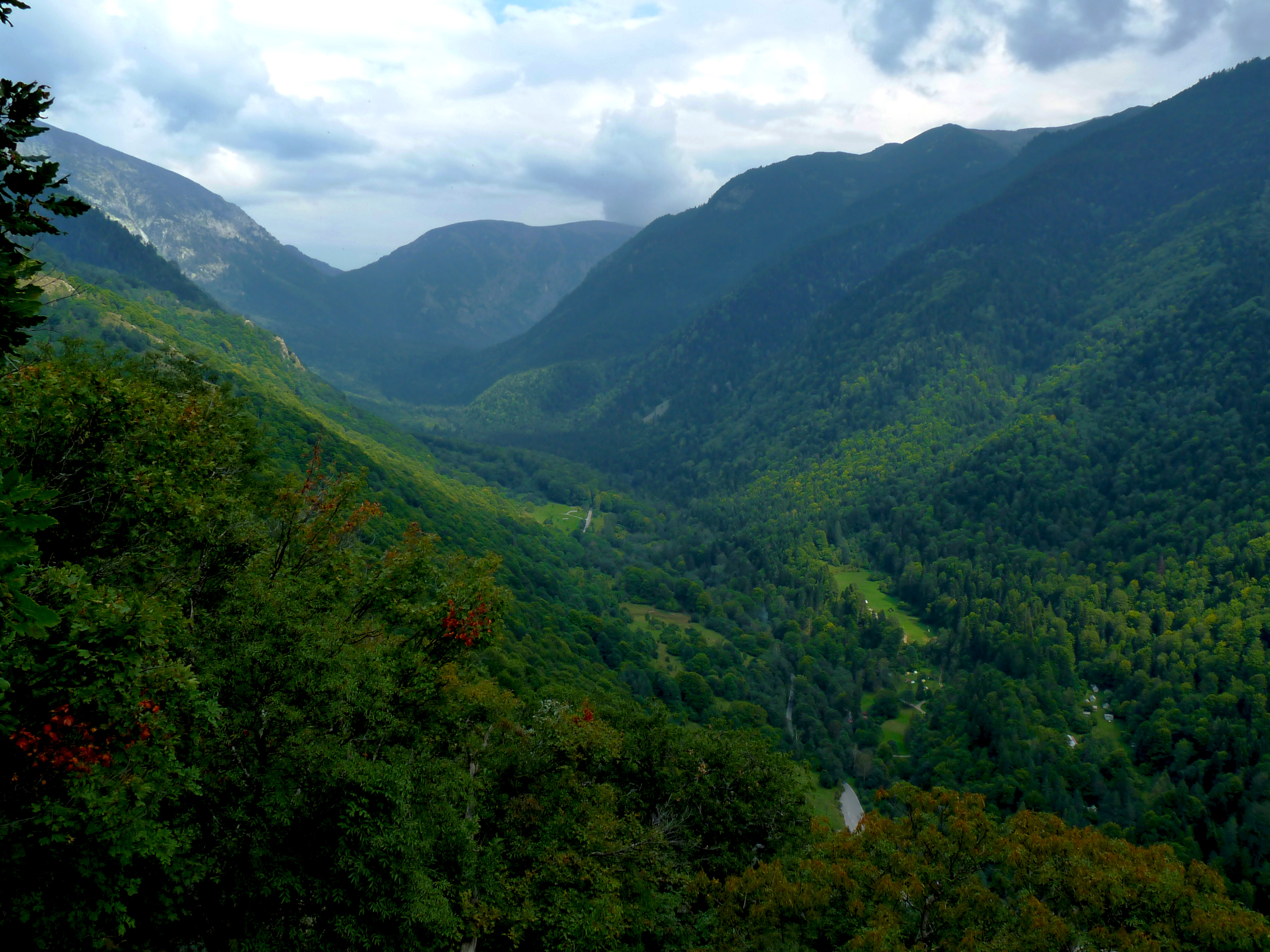 ###### *First view point near The Long Ridge - the valley of Rilska river where the monastery is located* <br> </br> 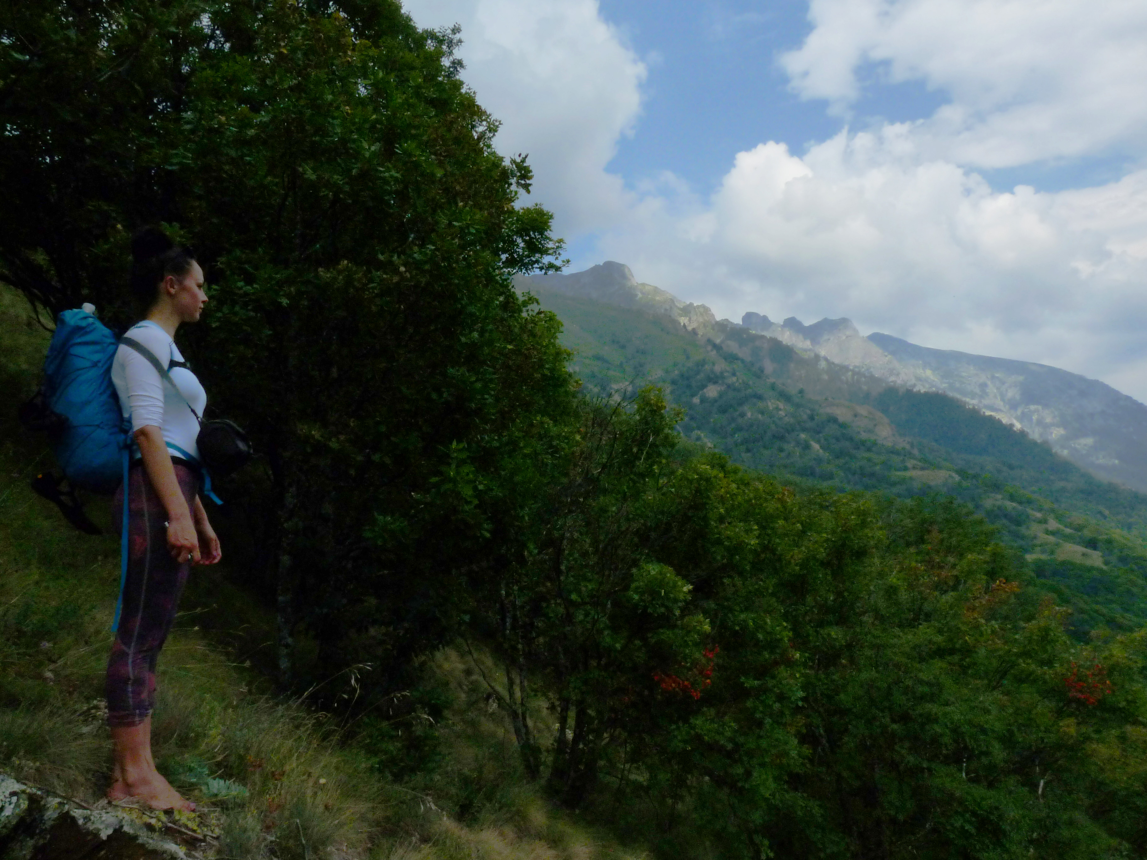 ###### *And me near the first view point* <br> </br> 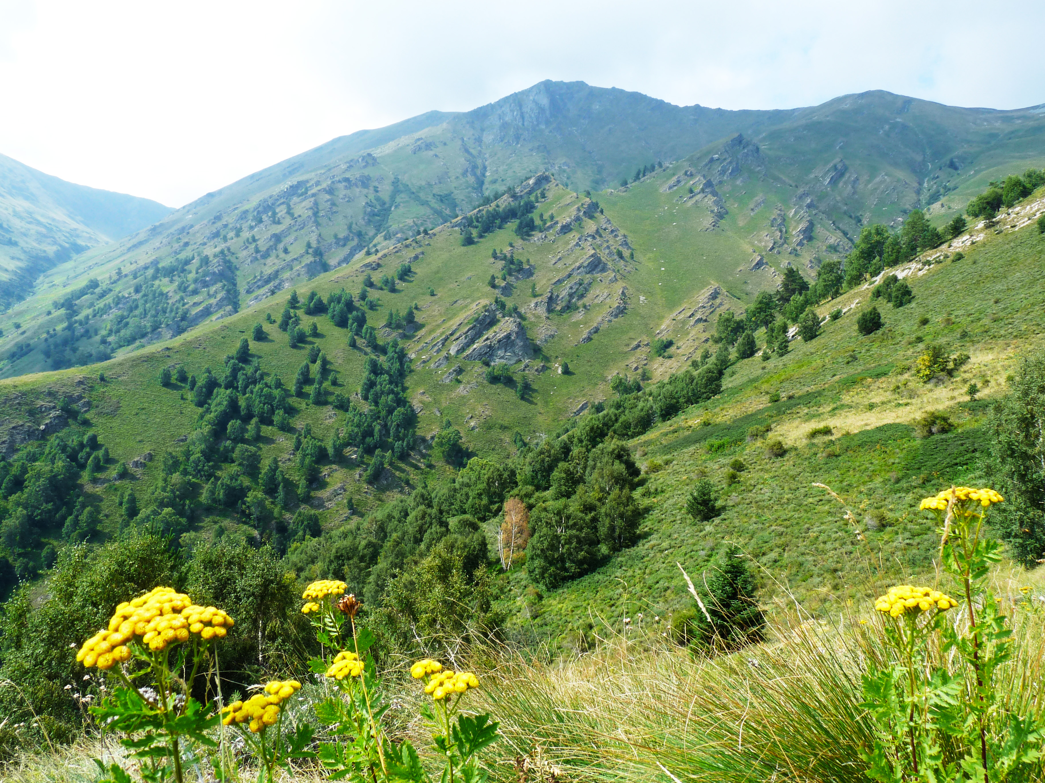 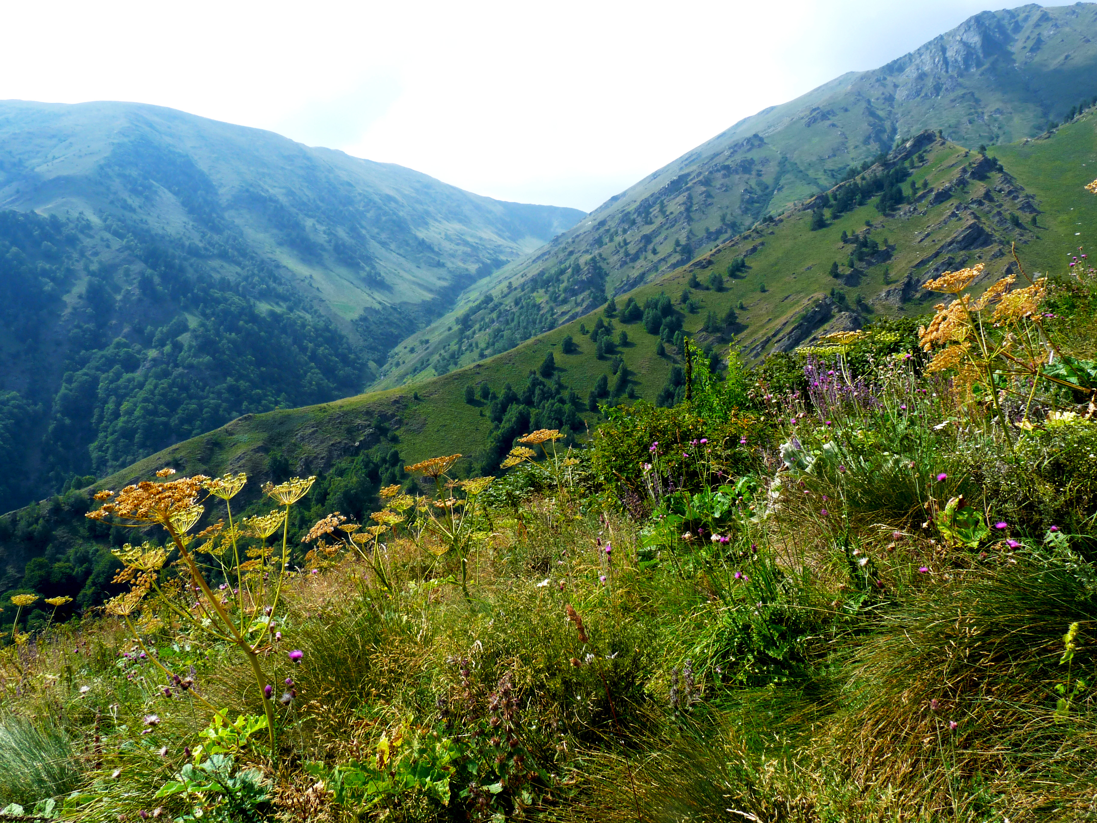 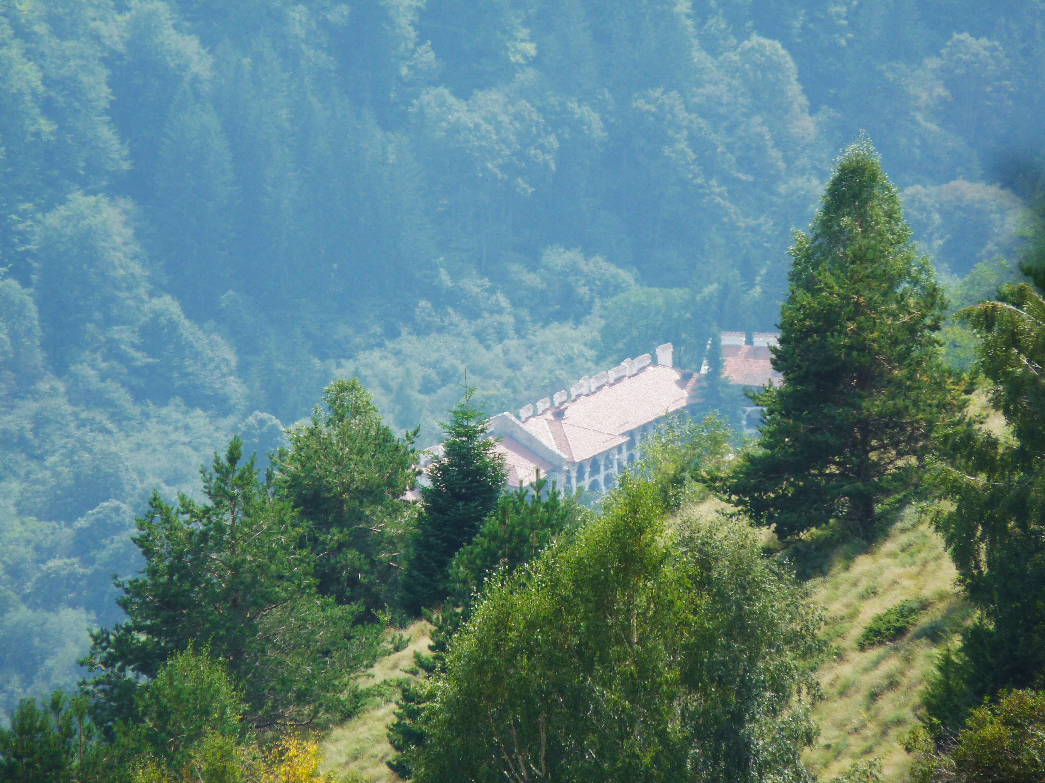 ###### *A very zoomed photo of the monastery from The Long Ridge. Half of the way is done* <br> </br> 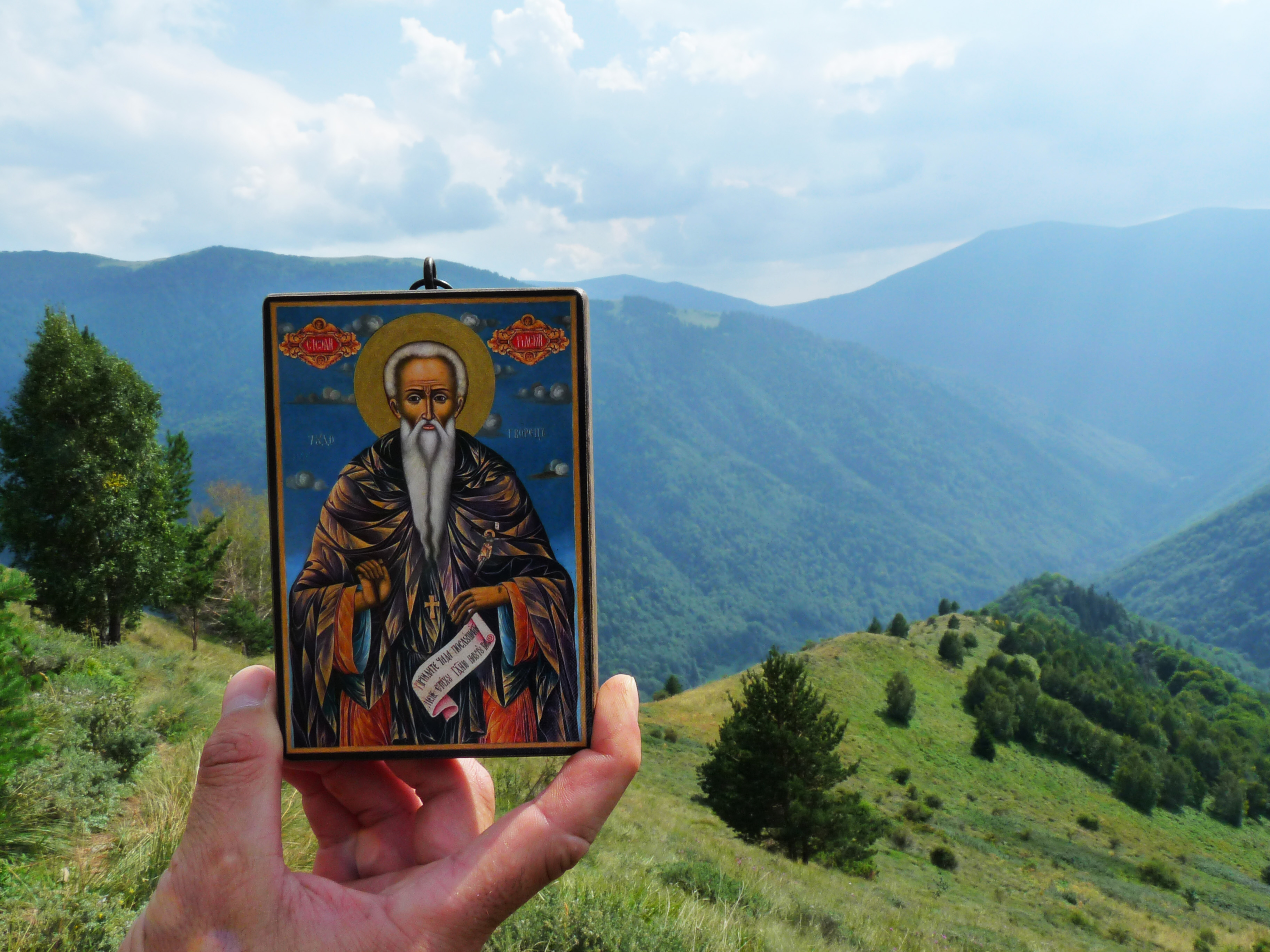 ###### *The icon of St. Ivan Rilski and The Long Ridge* <br> </br> 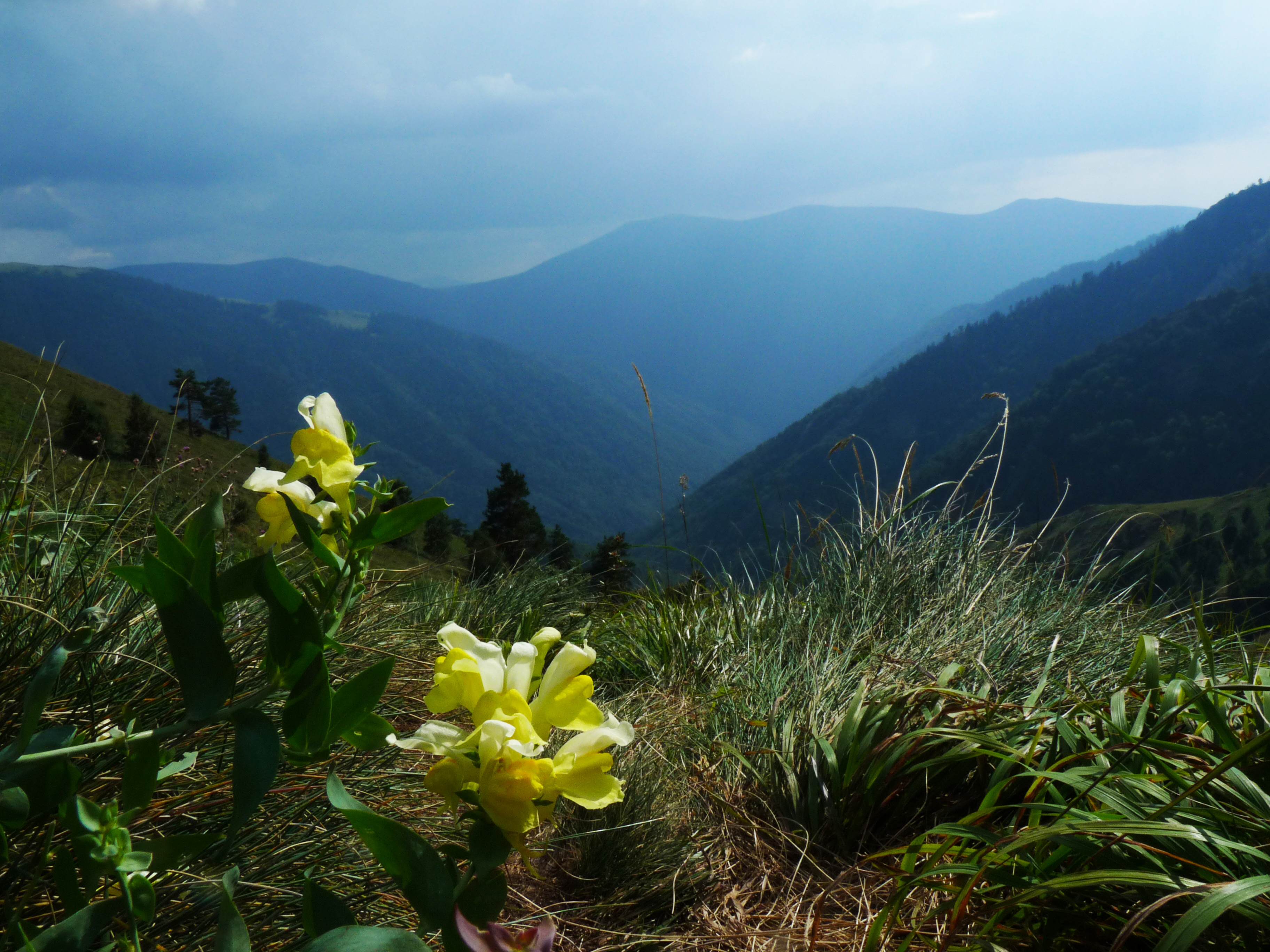 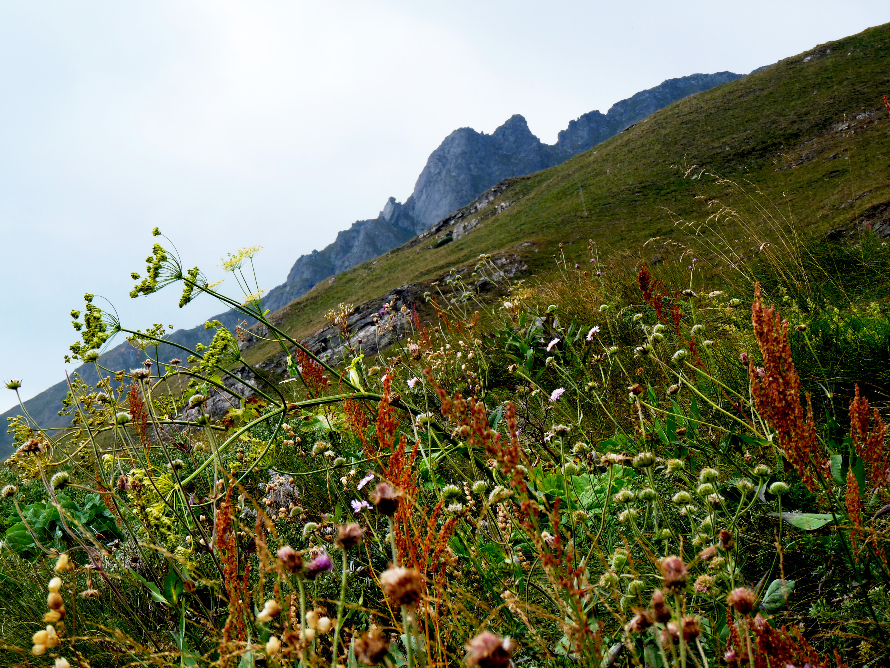.jpg) 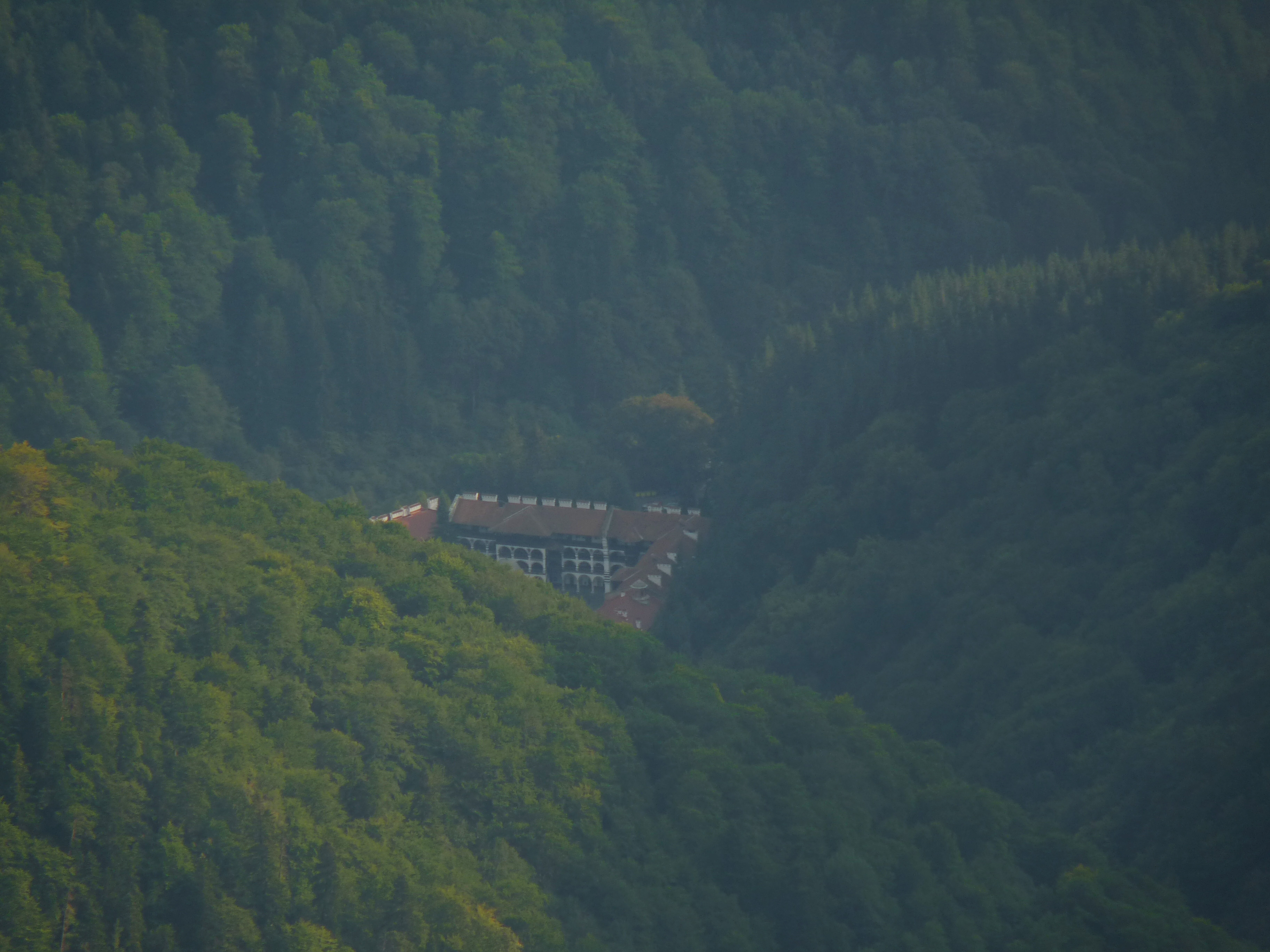 ###### *The monastery from almost the end of the endless long ridge* <br> </br> Our final destination for the day was Dodov Peak - 2,661m (8,730 ft). We started from 1,147m which means we had to go 1,500m higher for a little more than 4 hours. More about our next steps in my next posts. <br> </br> Thank you very much for hiking with me :) [//]:# (!steemitworldmap 42.134948 lat 23.341993 long d3scr)
👍 danielapetk, onart, busy.org, dejan.vuckovic, blessed-girl, loveisintheair, spiritualityed, dream.trip, hr1, cmp2020, cub1, acknowledgement, teaholik, sensation, blastik, melip, harkar, travelfeed, lizanomadsoul, momogrow, world-travel-pro, nolasco, philfreetotravel, justdentist, dawnsheree, silenteyes, qrwizard, rebeccaontheroof, gabrielatravels, itsben, wanderlass, kinggamero, mrprofessor, smeralda, exploreand, fromheart, criticker, niouton, travelfeed-bot, aktivsoul, smelv, maeusenews, dikkie, milkabustamante, lifegrande, jnmarteau, opt2o, globalschool, ideamachine, innovations, pizzajohn, tomnoble, generationeuropa, emmanomadsoul, onoschool, mundharmonika, ultrabiker, thescubageek, rimicane, cleverclogs, adonisabril, charisman, dboontje, jeanpi1908, alnedkov, minatubo, swolesome, gambit.coin, piligrim, flashfiction, promoteus, ifunanyaikemma, otto11, jayo, greenville, for91days, mindscapephotos, alinabarbu, senorcoconut, iwanderela, indayclara, uasteem, neutr0nic, theseahorse, spuutim, yadeshina, trayan, enosh, steemitworldmap, siriusgaia, rt395, martibis, lpv, onethousandpics, crimsonclad, discordiant, r00sj3, lordnigel, nameless-berk, galenkp, stuffing, poeticsnake, mandelsage, yougotsnekked, georgipraskov, dante31,