🌐 What in the World is This? ~ Investigating Objects Seen from a Plane. {#2}
photography·@steempowerpics·
0.000 HBD🌐 What in the World is This? ~ Investigating Objects Seen from a Plane. {#2}
On my recent winter vacation to Utah I got to witness some really interesting things on the ground during the two cross-country flights. For those of you who have followed my posts for a while know I love photography, and have a passion for aviation and taking photos out the windows during flights. When I find something curious on the ground I like to try to investigate what it was when I get back home. This is the second in a serious of **"What in the World is That?"** posts I will create tracking down features on the ground that caught my attention. <center>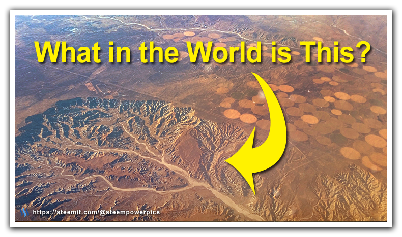</center> This feature something very unique that I have never seen before while flying. No, not the agriculture crop circles, but the massive river canyon and basin area. From this view as we passed by, it looked very out of place. Like a single puzzle piece cut from the otherwise relatively flat landscape. <center>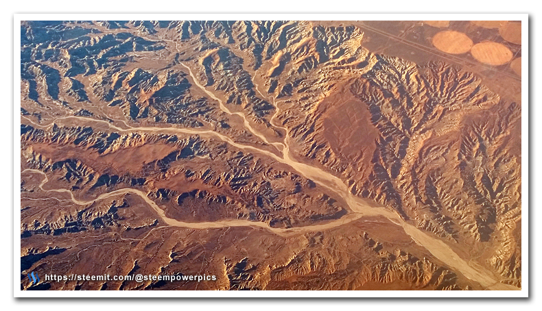</center> Once again I quickly snapped some pictures, then pulled up the flight map on the in-flight display screen to see roughly where we were as we fly by. This is a super useful tool available to us now, years back I would have to make educated guesses to the general location based on the flight time and its relative location from a recognizable landmark we passed along the way. <center>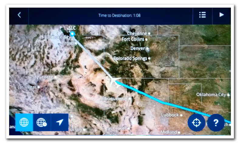</center> With these images and general map location, I pulled up our favorite "know-it-all" Uncle Google to pin down the location on the map. Surprisingly this was a rather unique feature on the ground and was pretty quick to find. I discovered it was part of the San Juan Basin Badlands and includes the Angel Peak Scenic Area in New Mexico. This feature while big, is actually a smaller basin compared to other erosion basin areas I found to the West of this on the map. <center>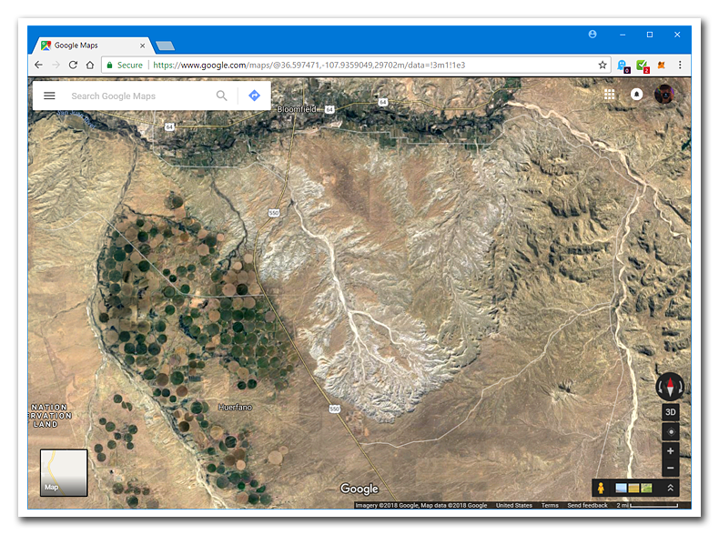</center> > The Angel Peak Scenic Area is a BLM recreation area located about 15 miles south of Bloomfield in San Juan County, New Mexico. The recreation area, more than 10,000 acres of rugged terrain, features Angel Peak, colorful badlands and deep canyons.<br><br>At 6,988 feet, Angel Peak is only a minor summit, rising just a little way above the high desert plains of northwest New Mexico, and sits in the middle of a rolling expanse of pastel-colored badlands, cliffs and dry washes, similar to the Bisti and De-Na-Zin wilderness areas 25 miles southwest - all are part of a general collection of eroded landscapes known as the San Juan Basin Badlands.<br><br>~*Wikipedia and AmericanSouthwest.net* <center>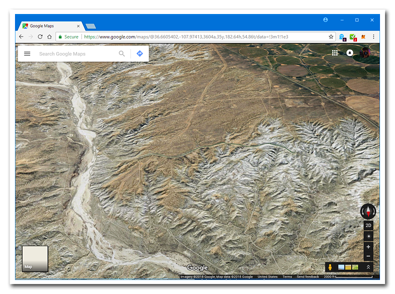</center> It was very cool to see all the intricate features of this geological formation from 36,000 feet above the ground. The eroded cliffs and dried water outflow channels looked like something from another world. Given the vast expanse of the badlands it was incredible that it all fit within the view of a small airplane window. > The badlands were produced by erosion of three strata; Kirtland Shale, the San Jose Formation and the Nacimiento Formation, and also contain large but isolated specimens of petrified wood, here an attractive grey-bluish colour. The barrenness of the terrain is due to high soil alkalinity and poor drainage, which prevents almost all vegetation.<br><br>~*AmericanSouthwest.net* <center>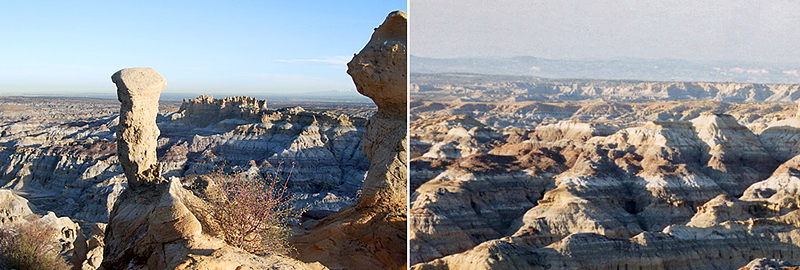<br><sub>*http://www.americansouthwest.net/new_mexico/angel_peak/nra.html*</sub></center> These photos give you the view of these canyons from ground level. It's amazing how different it looks from the sky. I hope you enjoyed unraveling the mysterious formation from my vacation travels. I will have another mystery location revealed soon. <hr> [//]:# (!steemitworldmap 36.582452 lat -107.707214 long Badlands/Angel Peak, New Mexico d3scr) ### Steemit WorldMap ### This post has a location marker in it for the @SteemitWorldMap project by @blueorgy and @martibis. By placing a location marker tag in your travel post it will show up on SteemitWorldmap.com 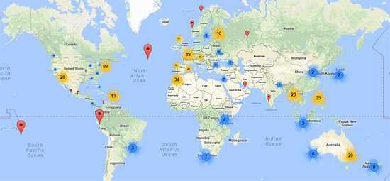 <hr /> <br /> <p>Let me know what you think, please leave your comments below.</p> <p>As always, <strong>please upvote this post and follow me</strong> if you like my work and want to see more.</p> <h2>If you think others will enjoy this<br>Please ReSteem it!</h2> <p><br /></p> <p>Thanks for reading!<br />